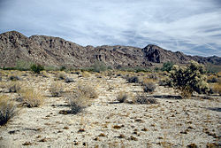
A "new" fault was recently discovered parallel to the San Andreas Fault, near the Salton Sea, just south of Joshua Tree National Park, in the Colorado Desert of California.

The Salton Sea was formed in 1905, when heavy rains caused the Colorado River to burst an Imperial Valley dike. It is now an important bird refuge.

The newly-mapped Salton Trough Fault located in the endorheic (or internally draining) Salton Sea could impact current seismic hazard models in the earthquake-prone region that includes the greater Los Angeles area.

These hazard models help protect lives and reduce property loss from earthquakes, says study lead author Dr. Valerie Sahakian.

“To aid in accurately assessing seismic hazard and reducing risk in a tectonically active region,” she explains, “it is crucial to correctly identify and locate faults before earthquakes happen.”

Researchers used a suite of instruments including multi-channel seismic data, ocean-bottom seismometers, and light detection and ranging (LIDAR) to map the deformation precisely within the various sediment layers in and around the bottom of the Salton Sea. The results reveal a strike-slip fault similar to the San Andreas Fault, with horizontal motion.

While further research is needed to determine how the Salton Trough Fault interacts with the San Andreas Fault, residents in the area are understandably shaken up (pun intended). Other recent studies have revealed that the region has experienced significant earthquakes (magnitude about seven) roughly every 175 to 200 years for the last thousand years. A major rupture on the southern portion of the San Andreas Fault has not occurred in the last 300 years.

“The extended nature of time since the most recent earthquake on the southern San Andreas has been puzzling to the earth sciences community,” says co-author Graham Kent. “Based on the deformation patterns, this new fault has accommodated some of the strain from the larger San Andreas system, so without having a record of past earthquakes from this new fault, it’s really difficult to determine whether this fault interacts with the southern San Andreas Fault at depth or in time.”

“We need further studies to better determine the location and character of this fault, as well as the hazard posed by this structure,” confirms Sahakian. “The patterns of deformation beneath the sea suggest that the newly identified fault has been long-lived and it is important to understand its relationship to the other fault systems in this geologically complicated region.”
Whose fault is/was it anyway? If the engineers had not created the "faulty" Imperial Dikes which flooded the Colorado Desert of California creating the Salton Sea, would we have known about this fault much sooner?
Steph

The Salton Sea was formed in 1905, when heavy rains caused the Colorado River to burst an Imperial Valley dike. It is now an important bird refuge.

The newly-mapped Salton Trough Fault located in the endorheic (or internally draining) Salton Sea could impact current seismic hazard models in the earthquake-prone region that includes the greater Los Angeles area.

These hazard models help protect lives and reduce property loss from earthquakes, says study lead author Dr. Valerie Sahakian.

“To aid in accurately assessing seismic hazard and reducing risk in a tectonically active region,” she explains, “it is crucial to correctly identify and locate faults before earthquakes happen.”

Researchers used a suite of instruments including multi-channel seismic data, ocean-bottom seismometers, and light detection and ranging (LIDAR) to map the deformation precisely within the various sediment layers in and around the bottom of the Salton Sea. The results reveal a strike-slip fault similar to the San Andreas Fault, with horizontal motion.

While further research is needed to determine how the Salton Trough Fault interacts with the San Andreas Fault, residents in the area are understandably shaken up (pun intended). Other recent studies have revealed that the region has experienced significant earthquakes (magnitude about seven) roughly every 175 to 200 years for the last thousand years. A major rupture on the southern portion of the San Andreas Fault has not occurred in the last 300 years.

“The extended nature of time since the most recent earthquake on the southern San Andreas has been puzzling to the earth sciences community,” says co-author Graham Kent. “Based on the deformation patterns, this new fault has accommodated some of the strain from the larger San Andreas system, so without having a record of past earthquakes from this new fault, it’s really difficult to determine whether this fault interacts with the southern San Andreas Fault at depth or in time.”
“We need further studies to better determine the location and character of this fault, as well as the hazard posed by this structure,” confirms Sahakian. “The patterns of deformation beneath the sea suggest that the newly identified fault has been long-lived and it is important to understand its relationship to the other fault systems in this geologically complicated region.”
Whose fault is/was it anyway? If the engineers had not created the "faulty" Imperial Dikes which flooded the Colorado Desert of California creating the Salton Sea, would we have known about this fault much sooner?
Steph


.jpg)

