Total Pageviews

Showing posts with label calcite. Show all posts

Wednesday, July 29, 2015

Geologic Tools of the Trade: No Monkey Wrenches Here, Only Bruntonian Motion

     Thanks, Lego Joe, of Puzzleria! fame for the suggestion to write about geologic tools of the trade, an extension from the NPR Sunday Puzzle about auto mechanics' tools of the trade.

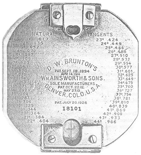
      My two favorite field geologic tools are my Brunton Compass:


and my Estwing rock hammer:


[It did look like this when it was new:]


          And now it looks like this (rock hammer, Brunton, and Brunton case):


     The Brunton compass is used primarily to take the strike and dip of rocks in an outcrop as described in this three-minute video.


    The Brunton compass (actually the Brunton Pocket Transit) is a precision compass made by Brunton, Inc. of Riverton, Wyoming. The instrument was patented in 1894 by a Canadian-born Colorado geologist, David W. Brunton. 


      Unlike most modern compasses, the Brunton Pocket Transit utilizes magnetic induction damping rather than fluid to damp needle oscillation. 


     From the Wikipedia article on the Brunton Compass:

      "With the advent of portable electronic devices a new generation of compasses has emerged, some again of specific interest to geologists. Unlike analogue compasses, a digital compass relies on an accelerometer and a teslameter, and may provide much information as to the reliability of a measurement (e.g. by repeating the same measurement and performing statistical analysis). Programmers of today's smartphones have responded with different geological compass apps. However, caution must be exercised: Because the Earth's magnetic field fluctuates rapidly, 'smartphone' 3 axis magnetometers can potentially measure noise. Furthermore, all smartphones create strong magnetic fields that must be corrected by computer algorithms. At present, all geological compass apps should be tested against traditional magnetic compass measurements."


     My trusty Brunton was also used for siting along with a plane table and alidade in barite mapping in Mexico. Here's a photo of Francisco who was my bodyguard and occasional rod man 


while I tromped around on the rocks, measuring strike and dip, sampling thick barite beds, and dropping acid 
(a mixture of Alizarin red S and potassium ferricyanide dissolved in a dilute hydrochloric acid solution)


 on rocks to determine if the carbonate was calcite (bright red or pink) or dolomite (white, brownish-grayish-greenish or clear). 


       I used my Brunton to measure the strike of metamorphic features in addition to sedimentary layers. The Brunton is still used by geologists, archeologists, and other scientists (though the price is now between $350-$700; I bought mine used for $75 and that was a really good deal.)

       My rock hammer has pounded on rocks from Spain to Mexico to all over the U.S. Field geology is a truly a blast!

       Two of my other favorite "tools?" A tractor and a backhoe used to dig trenches to get a better look at the thick barite beds beneath the surface in Cobachi, Sonora, Mexico. 


What's your most trusted tool?
Steph


Tuesday, February 11, 2014

Icelandic Plate Tectonics: No Scree-ching Halt: Give It an Inch and It'll Take A Year


     At long last, we are ready for the trip to Iceland now that the Viking Sunstone (optical Iceland spar or calcite) has been found:


     Optical calcite is rhombohedral and refracts light in a way that Norse explorers of 900-1200 A. D. were likely able to locate the sun even after sunset and on cloudy days. In those pre-GPS days, the calcite rhomb was accurate to within 1 degree:


     Optical calcite is found in abundance in the scree of Iceland, though it is now a protected resource since Icelandic tourism has recently blossomed. You may read more about calcite here, but I want to get us to Iceland, the only place on earth (currently) where a mid-oceanic ridge occurs on land:


     To repeat, Iceland is the ONLY place on our planet where one may actually witness oceanic crust being created on land. All other parts of the global mid-oceanic ridges are deep beneath the surface of the ocean. These folks are walking between two tectonic plates, the North American plate and the Eurasian plate, in Iceland:


     The theory of plate tectonics
describes the large-scale motions of the lithosphere. A good, general overview of the theory may be found here:


     The divergent boundaries between plates, known as mid-oceanic ridges, are the places where oceanic crust is created. There is a particularly good color, animated graphic in the link below (and shared here) which shows the new basalt (nicknamed MORB for Mid-Oceanic Ridge Basalt) or gabbro being created:


     Oceanic crust is richer in iron and magnesium making it heavier than continental crust, which is richer in lighter silica. The very newest "skin of the earth"  is created at mid-oceanic ridges. As one moves away from the center of the ridge, the oceanic crust is progressively older on mirroring sides of the ridge. Almost all oceanic crust is 200 million years old or younger, fairly young in geologic terms. Then, at the margins with lighter continental crust, the oceanic crust dives beneath the lighter continental crust and is essentially recycled. The major plates and their current movements are shown below:


     In Iceland, one may witness this new "baby earth skin" creation directly. In the land of fire and ice, you can actually touch this brand new earth as the mid-oceanic Atlantic ridge runs right through Iceland:


       The Eurasian and North American plates are moving apart at the rate of about an inch a year. There is no scree-ching halt to the oceanic plate movement due to the convection currents in the earth. The convection is akin to heating up pudding on the stove. The rising hot pudding comes to the surface then plunges back down again as it cools at the surface. 

        To witness new earth being created is, for me, amazing. After seeing the volcanos, ice, spar, and other Icelandic delights, here's that optional side trip to the Lucky Leif bridge in southwestern Iceland. It's a moment to ponder the earth's dynamic nature while straddling the two tectonic plates. Our trip would have been unabridged without it. :-) Enjoy!

        I welcome your comments, insights, and any sparring. 


      Here's to MORB excitement with all of you gab-BRO and SIS enthusiasts,

      Word Woman (aka Scientific Steph)