Total Pageviews

Wednesday, October 26, 2016

Whose Fault Was It Anyway?: The Endorheic Salton Sea and A "New" Salton Trough Fault

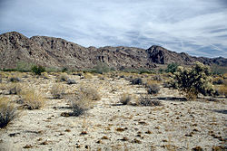
      A "new" fault was recently discovered parallel to the San Andreas Fault, near the Salton Sea, just south of Joshua Tree National Park, in the Colorado Desert of California.


       The Salton Sea was formed in 1905, when heavy rains caused the Colorado River to burst an Imperial Valley dike. It is now an important bird refuge.


     The newly-mapped Salton Trough Fault located in the   endorheic (or internally draining) Salton Sea could impact current seismic hazard models in the earthquake-prone region that includes the greater Los Angeles area. 


      These hazard models help protect lives and reduce property loss from earthquakes, says study lead author Dr. Valerie Sahakian.


      “To aid in accurately assessing seismic hazard and reducing risk in a tectonically active region,” she explains, “it is crucial to correctly identify and locate faults before earthquakes happen.”


     Researchers used a suite of instruments including multi-channel seismic data, ocean-bottom seismometers, and light detection and ranging (LIDAR) to map the deformation precisely within the various sediment layers in and around the bottom of the Salton Sea. The results reveal a strike-slip fault similar to the San Andreas Fault, with horizontal motion.


      While further research is needed to determine how the Salton Trough Fault interacts with the San Andreas Fault, residents in the area are understandably shaken up (pun intended). Other recent studies have revealed that the region has experienced significant earthquakes (magnitude about seven) roughly every 175 to 200 years for the last thousand years. A major rupture on the southern portion of the San Andreas Fault has not occurred in the last 300 years.


     “The extended nature of time since the most recent earthquake on the southern San Andreas has been puzzling to the earth sciences community,” says co-author Graham Kent. “Based on the deformation patterns, this new fault has accommodated some of the strain from the larger San Andreas system, so without having a record of past earthquakes from this new fault, it’s really difficult to determine whether this fault interacts with the southern San Andreas Fault at depth or in time.”


      “We need further studies to better determine the location and character of this fault, as well as the hazard posed by this structure,” confirms Sahakian. “The patterns of deformation beneath the sea suggest that the newly identified fault has been long-lived and it is important to understand its relationship to the other fault systems in this geologically complicated region.”

Whose fault is/was it anyway? If the engineers had not created the "faulty" Imperial Dikes which flooded the Colorado Desert of California creating the Salton Sea, would we have known about this fault much sooner?
Steph

Saturday, October 22, 2016

You're So Vein: Strahler Stream Order Classification System and Open-Source QGIS

       A colorful new map shows the complicated network of rivers and streams in the contiguous United States, dominated, of course, by the Mississippi River catchment area, shown in pink below.


       The map was created by Imgur user Fejetlenfej, using open-source QGIS (Geographic Information System) software.


      The map creator also used Strahler Stream Order Classification, with higher stream orders indicated as thicker lines. 


      There are 18 major river basins in the 48 states of the contiguous US, but, as noted above, much of the map is dominated by the massive catchment area for the Mississippi River, including the Upper and Lower Mississippi River Basins, along with Missouri River Basin and the Arkansas-White-Red Basin.


      The map is not perfect (note the straight-line, perpendicular, feathery lines within the Great Lakes, rather than solid bodies of water)


as well as the inconsistencies in the Columbia River-Snake River Plain area.


        The most exciting part of the map, for me, though, is that all the data were obtained gratis and put on an open-source GIS platform. It makes a dazzling display (overlooking those few issues). And people are buying it on Etsy! Maps getting good press is always exciting. 


     Maizie (pictured here on her 10th birthday Monday) and I are off to enjoy our 80 degree October day. Maybe we'll even hike streamside ;-) with a stream of consciousness running in our heads. . .


Are you live streaming streams this week? Steph


Thursday, October 13, 2016

Vinicunca Rainbow Mountain in the Andes of Peru: Dr. Seussian Stripes

      The "Rainbow in the Mountain" of Vinicunca in the Andes in Peru is so remote, it is hard to locate on Peruvian maps. Vinicunca doesn't yet have a Wikipedia page (as of today). But, the rainbow will blow you away.


       Located in a remote part of the Andes, somewhere near Cusco, (or Cuzco), Peru, the magical sedimentary layers appear unreal.


      I looked at a few blogs and guided trips to convince myself it really is real.


 From the little geologic research I could find about the area, the Permian formations with their distinct colors of red, ochre, and turquoise sandstones and (possibly) overlying Cretaceous, limestone layers create a wondrous landscape for alpaca, llamas, and horses.


The herding communities in the region constitutes one of the few remaining pastoralist societies in the world. High mountain trails are used by these herders to trade with agricultural communities at lower elevations.


I will see if I can locate the Rainbow Mountain of Vinicunca on Google Earth in the morning. 


Have a go if you'd like!

{It's been a long day. The state of emergency declared in Ethiopia means Zoë will likely be coming stateside in the next 30 days. We just don't know when.}

One more look at the Seussical stripes of Rainbow Mountain in Peru!


Steph

Update: Google Earth view of Rainbow Mountain or Vinicunca


Tuesday, October 4, 2016

How to Read Red Aspen Leaves: Anthocyanins and Sun Block for Leaves

     Why do some aspen leaves turn orange or red, rather than the more usual yellow or golden? Maizie, fearless and happy pup, and I were on our 16th annual autumn pilgrimage to Hell's Hole Trail on Saturday, pondering this very point.


      Since we've hiked the same trail on or about September 30th for 16 autumns, we've seen the same aspen tree turn yellow one year and bright orange or red the next few years, and back to yellow for a few years, then back to orange.


       I wrote in a 2014 PEOTS postscript (after my sign off) about it being a very orange year (lots of carotenoids). 2015 was overall much yellower; the reds and oranges were quite rare.  How much does moisture, temperature, soil conditions, or other factors affect the yellow, orange, or red of aspen? Ready, Maizie? Lead the way!


      First, a brief photosynthesis review: As deciduous trees prepare to lose their leaves, they begin to resorb nutrients and to slow chlorophyll production, unmasking other pigments that have been present all along. Yellow and orange leaf colors are due to xanthophyll and carotenoid pigments (see below).

Here's a handy chart showing all the leaf pigments:


  • Chlorophyll for greens
  • Carotenoids for orange
  • Xanthophyll of the Carotenoid group for yellow
  • Anthocyanins for reds and purples
  • Tannins for brown as a waste product

      Reds and purples, as noted above, are due to anthocyanins and these pigments are only produced in the autumn (by some plants). It is still not clear the role these red pigments play, and why a tree would spend energy to create them at a time when they are about to drop all their leaves. Hypotheses include reducing the risk of light-induced damage to leaf cells (sort of a sun block for the leaves), protection from cold, protection from insects, and helping leaves retain water.


        Some plants almost always produce red but, in some cases like aspen, only a few trees turn red. What makes them different?


      In 1989, Kuo-Gin Chang and his research team, then at Colorado State University, analyzed the pigments of yellow and red aspen and determined that all aspen produced carotenoids, but anthocyanins were only found in red aspens. The ability to produce anthocyanins appears to be a genetic trait that some aspen trees have, but most don’t.


      However, just because a tree can produce anthocyanins doesn’t mean that it always will. The researchers followed the trees they studied for five years. The trees that started off yellow stayed yellow, but some of the trees that started off red (i.e., they produced anthocyanins) were yellow in subsequent years. This demonstrates that both genes and weather cause the red. Years that produce the best reds have warm sunny autumn days followed by cool, but not freezing, nights.


      Not only do the red pigments of the anthocyanins protect leaves from the sun they also give some species extra time to absorb their essential leaf nutrients. As chlorophyll starts to exit the leaves, anthocyanins are being created to get the leaves additional time to unload the excess nutrients. Anthocyanins are a result of excess sugars within the cells and in combination with bright light, produce red pigment. Most anthocyanins are present only in autumn. One may observe a tree turning red at first and then changing to all yellow as days lengthen and rains come. The trees then need more food supply so they go into high gear and the leaves turn yellow.


       So, clearly, Maizie and I need more data within one season to see if the reds and oranges of certain aspen turn yellow later in the autumn.

Leaving it there for now; how's your aspen?
Steph


Wednesday, September 28, 2016

Geological Society of America Meets in Denver: Paleocene-Eocene Thermal Warming and Comparisons to Today's Global Warming

      An era of skyrocketing global temperatures started with an impact bang according to research presented September 27, 2016, here in Denver at the Geological Society of America's Annual Meeting.


         Impact debris and evidence of widespread wildfires in eastern North America suggest that a large space rock hit earth around 56 million years ago at the beginning of the Paleocene-Eocene Thermal Maximum, also known as the PETM, a period of rapid warming and huge increases in carbon dioxide.


     The event is one of the closest historic analogs to modern global warming and is used to improve predictions of how earth’s climate and ecosystems will fare in the coming decades.


     Too little is known about the newfound impact to guess its origin, size or effect on the global climate, said Dr. Morgan Schaller of Rensselaer Polytechnic Institute. But it fits in with the long-standing and controversial proposal that a comet impact caused the PETM. “The timing is nothing short of remarkable,” said Schaller at the GSA meeting.


     The impact may have contributed to the rapid rise in CO2 by stirring carbon up into the atmosphere, but it was hardly the sole cause, said Sandra Kirtland Turner, a geochemist at the University of California, Riverside. Her own environmental simulations suggest that the influx of carbon that flooded Earth during the PETM probably took place over at least 2500 years, far too drawn out to be caused by a single event, she said at the same meeting.


     During the PETM, a massive influx of carbon flooded the atmosphere and earth warmed by 5 to 8 degrees Celsius to temperatures much hotter than today. That carbon dump altered the relative abundance of different carbon isotopes in the atmosphere and oceans, leaving a signal in the sedimentary record.


     While searching for that signal in roughly 56-million-year-old sediments from sites up and down the U.S. east coast, Schaller spotted microscopic glassy spheres about the size of a dust mite as seen in SEM:


      These specks resemble those blasted from previously identified large impact events.


     After switching from a black to a white sorting tray to more easily see the black debris, researchers discovered abundant charcoal pieces in the mix, as seen below in a Scanning Electron Microscope (SEM) image. That charcoal likely formed when wildfires sparked by the impact raged across the landscape.


     More evidence of the impact will help researchers to better constrain its location, scope and possible relationship to the start of the PETM, Dr. Schaller said.

Have you ever made a simple change a la "black tray to white tray switch" to discover something new?
Steph

WE ARE CELEBRATING THREE YEARS OF PARTIAL ELLIPSIS OF THE SUN. . .

Wednesday, September 21, 2016

Antikythera Mechanism Shipwreck Revisited: Human Skeleton Over 2,000 Years Old Discovered at Site

      Parts of a 2,000-plus-year-old skeleton have been recovered from the shipwreck which contained an early analog computer, the Antikythera Mechanism, which we discussed here at Partial Ellipsis of the Sun in 2014.


      Researchers found the skeleton last August during their ongoing excavation of the wreck, which lies on the ocean floor off the Greek island of Antikythera in the Aegean Sea.


      “Against all odds, the bones survived over 2,000 years at the bottom of the sea, and they appear to be in fairly good condition,” Dr. Hannes Schroeder, DNA expert, of the Natural History Museum in Copenhagen, Denmark, said.


     The discovery consists of a partial skull with three teeth, arm and leg bones, and several parts of ribs as reported yesterday in Nature. They are the first bones to be recovered from the wreck, particularly exciting during this era of DNA sequencing.


       The passenger or crew member “was trapped in the ship when it went down and he or she must have been buried very rapidly or the bones would have (been) gone by now.” Some of the bones remain on the seafloor, but others have been brought to the surface for analysis.


      If the research team, which is led by experts from Woods Hole, can recover DNA from the skeleton, they may be able to confirm the individual’s gender and hair and eye color, as well as his or her ethnicity and geographic origin.


      The wreck, which is believed to be of a Greek trading or cargo ship, is the largest ancient shipwreck ever discovered. Since its discovery by sponge divers in 1900, divers have recovered extraordinary artifacts including glassware, gold jewelry,


marble statues and an ancient weapon known as a "dolphin,"


a lead and iron artifact that weighs about 220 pounds. "Dolphins" were defensive weapons that were dropped from the ship’s yard, a spar on the mast, onto the deck of an attacking ship, such as a pirate vessel. 

      The Antikythera Mechanism remains the star of the seafloor find, at least so far.


       These are the best of (DNA) times. . .


Speaking of times, we are close to the 3-year anniversary of Partial Ellipsis of the Sun on October first!

Steph